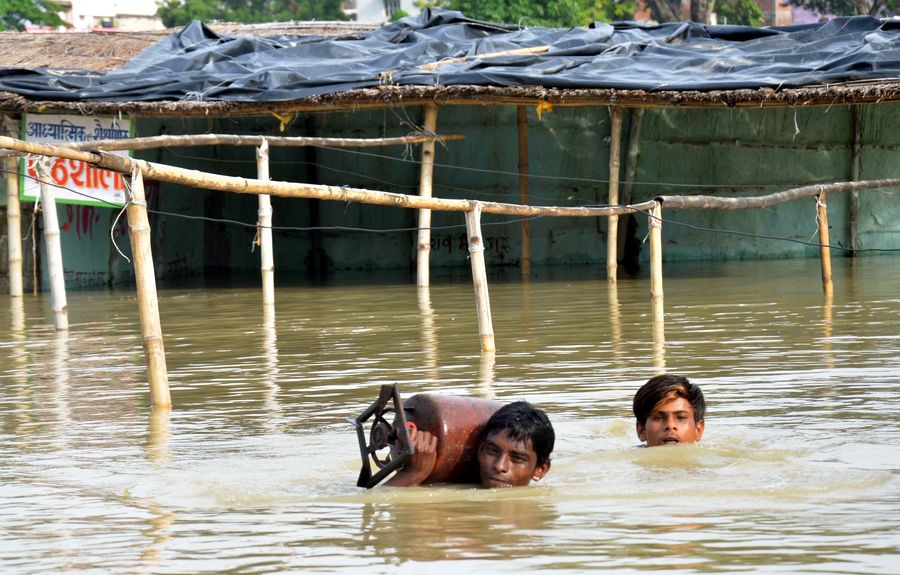
The file photo shows two boys carry a household item as they wade through a flooded street in Muzaffarpur district, Bihar, India, July 17, 2019. Many residents have been left homeless by recent flood caused by incessant rain in India's eastern state of Bihar. (Xinhua/Stringer)
On July 26, Chinese Ambassador to India Sun Weidong tweeted "Following ISRO (Indian Space Research Organization)'s request for international disaster relief support, China has provided India with satellite data on India's flood-hit regions to assist its flood relief efforts. Hope all gets well soon."
by Pankaj Yadav
SITAMARHI, Bihar, India, Aug. 3 (Xinhua) -- Sitamarhi is the worst affected district, besides 12 others, in flash floods in India's eastern state of Bihar, even as around 40 human deaths were reported from here out of the total 130 from across the state over the two weeks beginning July 15.
The main cause of floods in the low-lying areas of Bihar is the overflowing of several rivers flowing down from neighbouring country Nepal, which plays havoc in these places almost every year.
Xinhua correspondent travelled to the areas devastated by floods in Sitamarhi district to report from ground-zero and arrived at village "Dhaaptola" riding a rescue boat, only to see a village of around 200 houses. Most of the houses built in mud with thatched roofs are surrounded by the overflowing Bagmati river from all four sides.
The river had inundated almost all the houses for eight to 10 days beginning the night from July 14-15. The inhabitants had to spend several days on temporary bamboo stretchers which they put on roof-tops or other places above the water-level, even as it rained, sometimes heavily.
Flood-waters continue to inundate the villagers' agricultural fields, and boats provided by rescue teams, belonging to the State Disaster Response Force (SDRF), are the only mode of transport for them to nearby markets to buy daily necessities. Similar rescue teams of the National Disaster Response Force (NDRF) and the Indian Army are too pressed into service in nearby areas to extend relief and work to the flood victims.
The only pathway, an around 100-meter long bridge built with bamboo sticks, was washed away in flash floods, and the "Dhaaptola" village had remained cut-off from the rest of the state for at least five days before the relief and rescue teams arrived with rescue boats, relief material and medicines.
For want of medical help, a one-year-old boy died inside the village after suffering from high fever for several days together.
China was reportedly the first country to share satellite data and images of the flood-affected areas with the Indian government, particularly in Bihar and the north-eastern state of Assam. The satellite images were received from the Chinese satellite "Gaofen-2" on July 18, reported the English daily The Indian Express.
India's Ministry of External Affairs acknowledged China's help, and also the help which the government received from seven other nations, including the United States, Russia, France. The satellite data was received as a part of a multilateral mechanism for sharing space-based data for countries affected by natural or man-made disasters.
On July 26, Chinese Ambassador to India Sun Weidong tweeted "Following ISRO (Indian Space Research Organization)'s request for international disaster relief support, China has provided India with satellite data on India's flood-hit regions to assist its flood relief efforts. Hope all gets well soon."

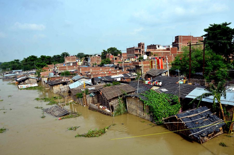
The file photo taken on July 17, 2019 shows flooded residences in Muzaffarpur district, Bihar, India. Many residents have been left homeless by recent flood caused by incessant rain in India's eastern state of Bihar. (Xinhua/Stringer)
India raised the request on July 17 and China was said to be the first country to send a set of satellite data in response to it. Other countries' space agencies gave information as and when their satellites passed over the area, said Indian media reports.
Reacting to this development, Sachindra Kumar Dubey, a rescue worker belonging to the SDRF, acclaimed China's help. "It is like a good neighbour's help. It was a very timely help that came from China, which actually helped India in deciding its course of action for rescuing the flood-hit victims and providing them with much needed relief," he added.
Besides the loss of human lives, a large number of cattle died in flash floods, even as standing crops, including rice, sugarcane, and vegetables, in several thousands of hectares of agricultural land were destroyed.
Apart from Bihar, more than 80 deaths have been reported from India's north-eastern state of Assam due to similar flash floods.
As of now, the situation in both Bihar and Assam is said to be under control, though the Indian Meteorological Department (IMD) has forecast of downpour in several parts of Bihar and other eastern parts of the country.
Meanwhile, flash floods have been reported from other parts of the country in the past couple of days, including Vadodara in western state of Gujarat and Ajmer in western state of Rajasthan.
Vehicles were seen stranded in waist-height water at both places, even as smaller vehicles like bikes and scooters were seen being washed away in fast streams of water on the main roads.


